Hotel Booking
Find Your Trip
Destination
-
-
Uttarakhand
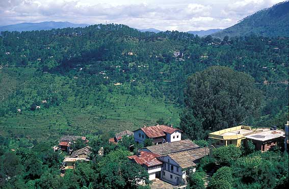
Uttarakhand is a place with great diversity of the region where snow-clad mountains, green hills, fertile valleys, flowing rivers and thriving lakes add to the natural beauty. Uttarakhand is also known as the Abode of the Gods, there are several highly venerated pilgrimage places. The tourists must visit Kedarnath, Badrinath, Hemkund Sahib, Gangotri, Yamunotri, Jageshwar, Bageshwar, Rishikesh, Haridwar for their religious importance on Uttarakhand Travel. Each hilltop or bent is known to have a temple, big or small, which are considered very sacred by the locals. Other tourist places to be visited are Lansdowne, Chakrata, Corbet National Park, Mukteshwar, Mussorrie, Dhanaulti, Binsar.
-
-
Dehradun
Dehra Dun is the capital city of the State of Uttarakhand in north India. Located in the Garhwal region, it is 255 km north of India's capital New Delhi and consists of 6 tehsils, 6 community development blocks, 17 towns and 764 inhabited villages.[3] The city has been chosen as one of the "Counter Magnets" of the National Capital Region (NCR) and is being developed as an alternative centre of growth to help ease the migration and population explosion in the Delhi metropolitan area. The climate of Dehradun is generally temperate, although it varies from tropical; from hot in summers to severely cold, depending upon the season and the altitude of the specific location. The nearby hilly regions often get snowfall during winter but the temperature in Dehradun is not known to fall below freezing. Summer temperatures can often reach 40°C whereas winter temperatures are usually between 2 and 20°C. During the monsoon season,
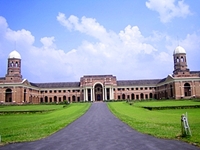
Dehradun is a popular tourist destination. The famous Tapkeshwar temple, Malsi Deer Park, Kalanga monument, Laxman Siddh, Chandrabani, Guchhupani, Forest Research Institute, Tapovan, Santala Devi temple and Wadia Institute are all situated here.[13] On the other side, away from the valley there are other attractions as well.
The tourist destinations in Dehradun can be divided into four or five areas: nature, sports, sanctuary, museums and institutions. The nearby hill stations are well known for their nature, temples for its faith dimensions, sanctuary for animal and bird lovers. Visitors can engage in activities like rafting, trekking and rock climbing. It is easy to get to the nearby hill stations like Mussoorie, Sahastradhara, Chakrata, Dakpathar and Lahkhamondal. Famous temples Tapkeshwar and Santala Devi are here along with amusement parks like fun and food and fun valley. There are museums and institutions for those who are interested in history and architecture. Dehradun can be visited in any season; the weather is best in September–October and March–April.
-
Lansdowne
An unexpected turn on the Kotdwar-Pauri road brings you to a pretty hill station, Lansdowne, in the Pauri Garhwal region of Uttaranchal. Lansdowne is set amidst lovely surroundings - tall oaks and blue pines rise like spires off the mountainside. The forests are lovely, dark and deep, just ideal for those long walks and picnics. There are amazing mountain views of the Western Himalayas from a number of vantage pints like Snow View and Tiffin Top. Serene and unspoilt, Lansdowne is a hill station in the secluded reaches of Uttaranchal. Surrounded by beautiful oak, silver fir, spruce, bamboo and pine forests, it is a summer getaway for nature lovers and romantics. From Delhi, the distance is approximately 230 km. Delhi - Ghaziabad - Meerut - Bijnor - Mawana - Kotdwar - Dugadda route to reach Lansdowne.
-
Chakrata
Kharamba peak is the highest mount in Chakrata with an altitude of about 10,000 ft. The mount climbing here is wonderfully an adventurous task. Nature lovers, Trekkers, bird watchers and wild life enthusiasts can spend days together here in the lap of Chakrata exploiting the nature’s hidden treasures and beauties. The forest around Chakrata has an amazing flora and fauna. This is the natural habitat of many wild life species including panther, spotted dear and wild fowls. Many caves and ancient temples nearby add the attraction to this cute beautiful town. Most of the town region are unexploited and unpolluted. Clear and clean atmosphere, calm environment and eye catching backdrops make the city a grandeur attraction for all kinds of tourists looking for tranquil and secluded stay.
-
Corbat National Park
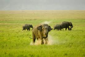
Corbett National Park has captured the imagination of many with its diverse wildlife and breathtaking landscapes. The natural uniqueness of the area was recognised long ago and so in 1936 Corbett attained the distinction as the first national park to be established in mainland Asia.Corbett National Park lies in two districts – Nainital and Pauri – in the hill state of Uttaranchal in northern India. It covers an area of 521 sq. km and together with the neighbouring Sonanadi Wildlife Sanctuary and Reserve Forest areas, forms the Corbett Tiger Reserve over 1288 sq. km. Its geographical location between the Himalayas and the terai, and the streams, rivers and ridges crisscrossing the terrain, present Corbett with a remarkable variety of landscapes. This vivid mosaic of habitats – wet and dry, plain and mountainous, gentle and rugged, forests and grasslands – supports numerous plant and animal species, representing Himalayan as well as plains kinds. The most famous of Corbett’s wild residents are the Bengal Tiger and the Asiatic Elephant, but with about 600 species of avifauna Corbett is one of the richest bird regions of India.
-
Mukteshwar
This beautiful place is 2286 mts in altitude and 51 Kms. from Nainital. Surrounded by fruit orchards and thick coniferous forest it was developed by the Britishers as research and education institute (IVRI) in 1893. It is the celebrated scenic spot overlooking long ranges of Himalaya.An old temple of Lord Shiva exist on the top of a rock. Situated at an altitude of 2286 mts. on Bhowali Devidhura road, Mukteshwar is a small hill station covered with a thick wooded forest and offers a majestic view of the Himalaya. Near Mukteshwar is a stone hole of Chauli Ki Jali, dedicated to Lord Shiva. On a moonlit light, the place offers a spectacular view of the sparkling town of Almora and the majestic peaks of Adi Nampa of Nepal stretching upto the Chaukhamba Peaks of Garhwal. It is also famous for the hundred year old Indian Veterinary Research Institute campus. Rail :Nearest railhead is Kathgodam, 73 kms. via Bhimtal & 76 kms. via Jeolikot-Bhowali. Road :Nainital 50 kms., Bhowali 39 kms. and Ramnagar 25 kms.

-
Rishikesh
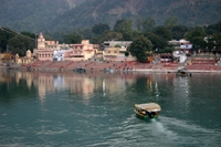
Rishikesh, a most tranquil place in northern Uttar Pradesh, surrounded by hills and bisected by the wide and sluggish Ganges, is often claimed as the `Yoga Capital of the World'. Back in the 1960s Rishikesh gained instant fame as the site where The Beatles came to stay with their guru, the Maharishi Mahesh Yogi. It is an excellent place to meditate and study yoga. Rishikesh is also a good starting Laxman Jhula point for treks to Himalayan pilgrimage centres such as Badrinath, Kedarnath , Gangotri, Yamnotri.It is rightly called the gateway to the Himalayan Shrines of Badrinath, Kedarnath, Gangotri and Yamunotri.
-
Mussorie
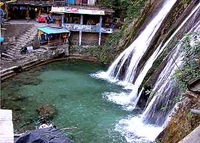
Mussori 38 Kms from Dehradun is Mussoorie with its green hills and varied flora and fauna, is a fascinating hill station. It offers a wonderful view of the Himalayan snow ranges to the north-east and the Doon Valley., Roorkee, Saharanpur and Haridwar to the South, creating an almost serene atmosphere for the tourists. Mussoorie was discovered by Captain Young, an adventurous military officer in 1827. He was lured by the extraordinarily beautiful ridge and laid the foundation of it. Mussoorie is also a Gateway to the “Gangotri” and the “Yamunotri” shrines.Camel’s Back Road ,Gun Hill ,Mussoorie Lake, Vinog Mountain Quail Sanctuary, Kempty Fall Mussoorie, the queen of hill stations, is famous for its scenic beauty, gay social life and entertainment. Climate Condition The climate of Mussoorie is mild and entirely comfortable in summers, temperature wavering below 30º C, winters are very cold, and temperature falls drastically.
-
Dhanaulti
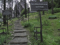
If you walk past the clock tower in Mussoorie and look between the plains and the rising slopes of Landour you will see a road to the green meadows and deodar forests of Dhanaulti. A perfect holiday destination with a new Eco Park which you will surely enjoy. It’s an actual hill forest village environment with Himalayan breeze and is a delightful place to spend a day.
-
Binsar
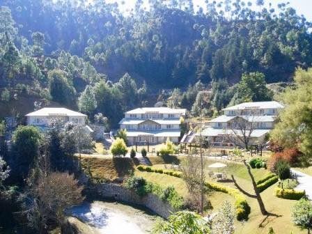
If you walk past the clock tower in Mussoorie and look between the plains and the rising slopes of Landour you will see a road to the green meadows and deodar forests of Dhanaulti. A perfect holiday destination with a new Eco Park which you will surely enjoy. It’s an actual hill forest village environment with Himalayan breeze and is a delightful place to spend a day.
-
-
Uttarakhand
-
-
Himachal
Nestled in the Himalayas, the world's mightiest mountain ranges, Himachal is blessed with some of the most spectacular landscapes anywhere. Truly a travellers paradise, with mighty snow peaks, deep gorges, lush green and golden valleys, flower filled meadows, misty woods, fast flowing icy rivers, glaciers and enchanting lakes. While the picturesque valleys of Kullu, Kinnaur and Kangra are a riot of colours, in marked contrast the barren terrain of Lahaul & Spiti have a stunning lunar landscape like beauty. For the visitor there are superb locations for relaxing and sight seeing. There are also tremendous opportunities for trekking, mountaineering, fishing, river rafting, skiing, para-gliding, ice skating and golf. Having an excellent network of roads and communication facilities, Himachal has a clean and peaceful environment.
-
-
Manali
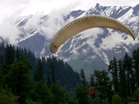
Manali in the Beas River valley is an important hill station in the mountains of the Indian state of Himachal Pradesh near the northern end of the Kullu Valley. It is located about 250 km (155 mi) north of state capital, Shimla. Manali is situated near the end of the valley on the National Highway leading to Leh. The landscape here is breath taking. One sees well-defined snow capped peaks, the Beas river with its clear water meanders through the town. On the other side are deodar and pine trees, tiny fields and fruit orchards. It is an excellent place for a holiday, a favorite resort for trekkers to Lahaul, Spiti, Bara Bhangal (Kangra), and Zanskar ranges. From temples to antiquity, to picturesque sight-seeing spots and adventure activities, Manali is a popular resort for all seasons and for all travellers. The climate in Manali is predominantly cold during winters, and moderately cool during summers.
-
Shimla
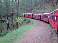
Simla, is the capital city of Himachal Pradesh. In 1864, Shimla was declared the summer capital of the British Raj in India. A popular tourist destination, Shimla is often referred to as the "Queen of Hills," a term coined by the British. Located in the north-west Himalayas at an average altitude of 2,205 metres (7,234 ft), the city of Shimla. Shimla has seen many important historical events such as the famous Shimla Pact between India & Pakistan which was signed here. The place is also famous for its natural beauty, architectural buildings, wooden crafts and apples. The climate in Shimla is predominantly cool during winters, and moderately warm during summer.
-
Dharamshala
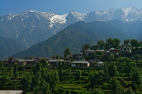
Dharamshalais a city in northern India. It is the winter seat of government of the state of Himachal Pradesh and the district headquarters of the Kangra district. It was formerly known as Bhagsu. This is a hill station lying on the spur of the Dhauladhar range about 17 kms north- east of Kangra town. This hill station is wooded with oak and conifer trees and snow capped mountains enfold three sides of the town while the valley stretches in front. The snowline is perhaps more easily accessible at Dharamshala than at any other hill resort and it is possible to make a day's trek to a snow-point after an early morning's start. Dharamshala is also the headquarter of the Kangra district.
CLIMATE : In winter, the temperature can drop to freezing point when heavy woolens are required. During summer, the climate is mild and light woolens / cottons are recommended.
-
Dalhousie
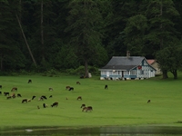
Dalhousie is a hill station and popular tourist spot in the northern state of Himachal Pradesh. Dalhousie is built on and around five hills. Located on the western edge of the Dhauladhar mountain range of the Himalayas, surrounded by the beautiful scenery of snow-capped peaks. Dalhousie is situated at 6000-9000 feet above sea level. The best time to visit is in the summer, and the peak tourist season is from May to September. Scottish and Victorian architecture is prevalent in the bungalows and churches in the town.Dalhousie experiences winter-like cold climate throughout the year. Heavy rain with thunder showers are experienced during the period from June to September. In May–July it is usually warm in the morning and afternoon but gets cold early in the evening and quite cold at night. The weather becomes very cold during winter and if it rains. Dalhousie also experiences snow during the peak of winter period in December and January. Being a hill station, Dalhousie is famous for its salubrious climate.
-
Khajjiar
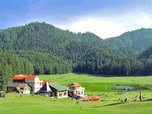
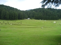
Khajjiar is a hill station in Chamba district, Himachal Pradesh, India, located approximately 24 km from Dalhousie. Khajjiar sits on a small plateau with a small stream-fed lake in the middle that has been covered over with weeds. The hill station is surrounded by green meadows and dense forests. It is about 6,500 feet (2,000 m) above sea level in the foothills of the Dhauladhar ranges of the Western Himalayas and snowy peaks can be seen in the distancE. Khajjiar is often reffered to as "Gulmarg of Himachal Pradesh". The lush green meadows are surrounded by thick pine and cedar forests. Grazing herds of sheep, goats and other milch cattle present a prefect pastoral scenery. There is a small lake in the center of the saucer shaped meadow which has in it a floating island. Much of the lake has degenerated into slush because of heavy silting during rains. Still the landscape of Khajjiar is picturesque and a photographer's delight.
-
Chamba
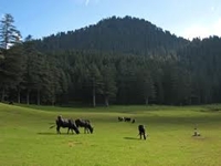
Chamba is an ancient town in the Chamba district in the state of Himachal Pradesh, This town was founded by Raja Sahil Varman when he conquered the lower Rani valley from the petty chiefs called Ranas and Thakurs in the beginning of 10th Century. It seems the original name of the town was Champa as mentioned in Kalhan's Rajtarangani. In the bansauli or genealogical rolls of the Chamba Rajas a reference occurs of place which was adorned with highly fragrant Champaka trees and guarded by Goddess Champavati or more popularly known as Chameshni. The temple was built by Sahil Varman in the honour of his daughter Champavati who is worshipped as a goddess in Chamba. Champavati temple became the family temple of the ruling family. The climate of Chamba in general is tempreate with well defined seasons. However, there may be variations because of micro-climatic systems depending upon altitude and mountain aspect. The winters last from December to February. March and April generally remain cool and dry but snowfall does occur at higher elevations during these months. The temperature begins to rise rapidly from the middle of April till last week of June or first week of July when monsoon breaks-in. Monsoon continues till the end of August or mid September. During the monsoon, the weather remains misty, humid and cloudy.
-
Kasauli
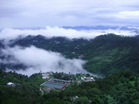
Kasauli is a cantonment and town, located in Solan district in the Indian state of Himachal Pradesh. Kasauli in recent past has come up as the most sought for tourist destination in comparison to other hill stations in Himachal Pradesh, like Shimla, Manali, Dharamsala & Dalhousie. Kasauli is only an hour drive from Kalka & one and half hours from Chandigarh. Kasauli has a moderate climate. Winter temperature is approximately 2 degrees celsius, with Summer temperatures rarely exceeding 32 degrees celsius. The general wind direction is south-west to north-east. Total rainfall for the year is 1020 millimetres, with humidity at 90% in September and 28% in April.
-
ChailKufri
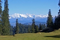
An enjoyable drive through forests and small villages leads to this small but popular station. The Nature Park here is a great attraction. A short trek leads to the Mahasu Peak with breathtaking views.Blessed with some of the most spectacular and beautiful landscapes anywhere, it is a travelers paradise -lofty snow peaks, deep gorges, lush green valleys, fast flowing rivers, enchanting mountain lakes, flower bedecked meadows, beautiful temples and monasteries steeped in time. May it be for relaxing, sightseeing, trekking, mountaineering, fishing, para-gliding, skiing, ice skating and golf, Himachal has it all...Come Explore Himachal with himachaltourist... Climate: In winter, the temperature can drop below freezing point when heavy woolens are required. In summer the climate is mild and light woolens/cottons are recommendable.
-
Naldehra
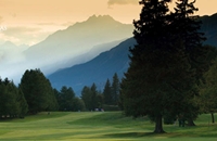
Naldehra (2044m) is a heaven for tourist located at distance of 22 km away from Shimla. It boasts of the oldest 9 hole golf course in the country. The well groomed golf Naldehra course is lovely and perhaps one of the finest and most sporty in India. Crowned with a springing turf the golf Course here was suggested by Lord Curzon and he was so enchanted by the place that he gave his daughter Alexendra Naldehra as her second name. It is the venue of many competitions. WelcomHeritage Chalets Naldehra is the first property built in India with the internationally recognized expertise that has come to be associated with Scandinavian log homes.
-
-
Himachal
-
-
Kerala
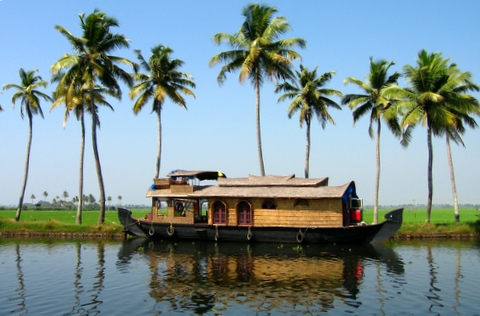
Kerala has been one of those intriguing places, rich in culture and traditional arts. In literature and films also, Kerala has a glorious presence. From Thakazi Sivasankara Pillai to Arundhuti Roy ---with Vasudevan Nair, O.P Vijayans and Vaikkom Basheers thrown in ample measures….Kerala can boast of six Jnanpith Awards and a Booker. Kerala is the beautiful girl on earth, South west part of India, between Western Ghats of Hills and the Arabian Sea with an area of approximate 39,000 sq.km. It is blessed with endless beaches, lush green forests, mountains, waterfalls, fertile land, banana, pineapple, papaya, mango, jackfruit grows in abundance in Kerala and palm fringed lakes and backwaters.
-
-
Kavalam
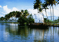
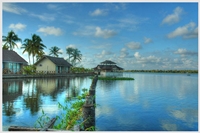
Kavalam is on of the Village in Veliyanad Taluk , Alappuzha District , Kerala State . Kavalam is 3.6 km far from its Taluk Main Town Veliyanad . Kavalam is located 14.9 km distance from its District Main City Alappuzha . It is located 124 km distance from its State Main City Thiruvananthapuram. Kavalam is a village in Kuttanad. This backwater village in Kerala state, India, is situated on the borders of Alapuzha and Kottayam Districts, on the banks of Vembanad Lake. The Pampa river flows through the village to merge into the famed Vembanad Lake. Its natural scenic beauty is legendary and has been used by many film makers. Relatively untouched by modernity, Kavalam is a green haven. Interspersed with the kayals (canals) and lakes, this belly of Kerala's backwaters is serene. The lakes and kayals are filled with flocks of ducks, and in summer the rice paddies of Kuttanad turn golden. With a longtime history behind it, Kavalam is part of Kerala's cultural folklore. A decade back, this sleepy village was accessible only by the lake boats provided by the Government of Kerala. As in many other remote parts of Kerala, this non-accessibility gave Kavalam a laidback atmosphere. The place is now accessible from Alleppey, Kottayam and Changanacherry by road. What makes Kavalam unique is its vast "watery junction" that joins five different canals at one place unlike other road junctions - a rare sight indeed!
-
Coachin
Extreme N Myanmar. It is a mountainous region bounded on the NW by India and on the N and E by China and traversed by tributaries of the Ayeyarwady River. Myitkyina, the capital, and Bhamo are the chief towns. Rice and sugarcane are grown, jade and amber mined, and timber and bamboo cut. The state is sparsely populated; Jinghpaw-speaking Kachins constitute the largest group. They maintain tribal forms of organization under chiefs, practice shifting cultivation, and are mostly animists or Christians. The territory was never subject to the Burman kings, and after the establishment of British rule it was governed directly, not as part of British Burma. The territory was invaded (1945—47) by the Chinese, but a border agreement was signed between Myanmar and China in 1960. Antigovernment insurgents,
-
Thekkady
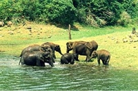
Thekkady in Kerala State , India 's largest wildlife sanctuary is a dream destination for any tourist visiting India . The 120 years old 'Surki' dam built across Peryiar, Poorna in Vedic parlance, is a major tourist attraction. This sanctuary is spread over an area of 777 Sq.Kms, surrounded by an artificial lake over an area of 25 Sq.Kms. The Country's sole Tiger reserve, Thekkady, with its bountiful treasures of tropical flora and fauna is the ultimate reservoir of many an endangered species and a rich tribal culture. Thekkady is a pleasant heaven on earth for those who love nature in its wild manifestations.
-
Mannar
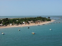
Mannar (Malayalam: is a major[citation needed] business town midway between Mavelikara and Tiruvalla, in Alappuzha District of Kerala state, India, on State highway 6. It is also known as the Bell Metal Town.[citation needed] It is situated on the banks of the Pampa River and Manimala River . Mannar is 9 km from Chengannur, Thiruvalla, Haripad and Mavelikara. It is connected by four railway stations (Chengannur, Thiruvalla, Harippad and Mavelikara) at a distance of 9 km each on four sides.
-
Varkala
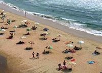
Varkala (Malayalam : is a coastal town and municipality in Thiruvananthapuram district situated in the Indian state of Kerala. It is located 50 kilometres (approx. 32 miles) north-west of Thiruvananthapuram (Trivandrum) and 37 km south-west of Kollam city. Varkala is the only place in southern Kerala where cliffs are found adjacent to the Arabian Sea.[1] These tertiary sedimentary formation cliffs are a unique geological feature on the otherwise flat Kerala coast, and is known among geologists as Varkala Formation and a geological monument as declared by the Geological Survey of India. There are numerous water spouts and spas on the sides of these cliffs. Varkala is also famous for the 2,000-year old Janardana Swami Temple which is an important Vaishnavaite shrine in India and is often referred to as Dakshin Kashi (Benares of the South). The temple is located close to the Papanasam beach, which is considered to have holy waters which wash away sins, and is also an important Ayurveda treatment centre. The temple has an ancient bell removed from a shipwreck, donated by the captain of the Dutch vessel which sank near Varkala without causing any casualties.
-
Kumarakom
Kumarakom is a popular tourism destination located near the city of Kottayam (16 kilometres (10 mi)), in Kerala, India, famous for its backwater tourism. It is set in the backdrop of the Vembanad Lake which is the largest freshwater lake in the state of Kerala. Kumarakom has a moderate climate throughout the year. It is a balanced tropical climate, which has two monsoons south west and north east. The average rainfall is 1100mm.Tourism in Kumarakom largely revolves around the backwaters of the Vembanad Lake. Several luxury and budget resorts lined up on the shores of the lake provide tourists with facilities for boating, yachting and fishing, with panoramic views of the lake. The other major attraction is the Bird Sanctuary which can be visited by canoes arranged by local fishermen at the entrance to the sanctuary. A two-hour rowing canoe trip is quite cheap, and is best undertaken in the evening or early morning to avoid the afternoon sun.

-
-
Kerala
-
-
Rajasthan
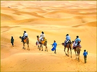
Rajasthanis, ("the land of kings"), is the largest state of the Republic of India by area. It is located in the northwest of India. It encompasses most of the area of the large, inhospitable Great Indian Desert (Thar Desert), which has an edge paralleling the Sutlej-Indus river valley along its border with Pakistan. The state is bordered by Pakistan to the west, Gujarat to the southwest, Madhya Pradesh to the southeast, Uttar Pradesh and Haryana to the northeast and Punjab to the north. Rajasthan covers 10.4% of India, an area of 342,269 square kilometres (132,151 sq mi). Jaipur is the capital and the largest city of the state. Geographical features include the Thar Desert along north-western Rajasthan and the termination of the Ghaggar River near the archaeological ruins at Kalibanga of the Indus Valley Civilization, which are the oldest in the Indian subcontinent discovered so far.
-
-
Jaipur
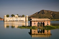
This famous city is the capital of Rajasthan and has earned universal renown as the " Pink City ", and pink it is, with beautiful constructed palaces, havelis and forts. Tall, rugged men with handle-bar whiskers sport bright pink turbans. Jaipur which means the city of victory was built exactly 273 years back and is 262 km by road from Delhi ( Capital of India ). A strong wall encircles the old city and even today has a suggestion of formidable strength, its function of protecting all within is obvious. Jaipur is a famous tourist destination in India. Many people come to Jaipur to view the various forts and monuments in which reflect its glorious past. Tourism is a significant part of Jaipur's economy. Along with up-scale hotels the facilities and future infrastructure developments are expected to increase the number of tourists. The plains of Rajasthan of which Jaipur is the capital once thundered and echoed with clash of swords and the drums of wars. Built in 1727 by Sawai Jai Singh-II, Jaipur was the first planned city of its time ( the earlier planned city in northern India having been built near Taxila sometime in the 2nd century BC ). Jaipur has a hot semi-arid climate (Köppen climate classification BSh) receiving over 650 millimetres (26 in) of rainfall annually but most rains occur in the monsoon months between June and September. Temperatures remain relatively high throughout the year, with the summer months of April to early July having average daily temperatures of around 30 °C (86 °F). During the monsoon there are frequent, heavy rains and thunderstorms, but flooding is not common. The winter months of November to February are mild and pleasant, with average temperatures ranging from 15–18 °C (59–64 °F) and with little or no humidity. There are however occasional cold waves that lead to temperatures near freezing.
-
Ranthambore
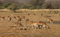
Ranthambore National Park is one of the biggest and most renowned national park in Northern India. The park is located in the Sawai Madhopur district of southeastern Rajasthan, which is about 130 km from Jaipur. Being considered as one of the famous and former hunting grounds of the Maharajas of Jaipur, today the Ranthambore National Park terrain is major wildlife tourist attraction spot that has pulled the attention of many wildlife photographers and lovers in this destination. The Park consists of typical dry deciduous elements with Anogeissus pendula forests - a dominant tree species. However, mix deciduous elements could be seen in the valleys and along water bodies. The Flora of the Park is represented by 539 species of flowering plants.
-
Bikaner
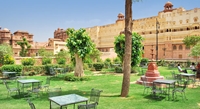
Bikaner ( pronunciation (help·info)) is a District in the northwest of the state of Rajasthan in northern India. It is located 330 kilometres (205 mi) northwest of the state capital, Jaipur. Bikaner city is the administrative headquarters of Bikaner District and Bikaner division. It was formerly the capital of the princely state of Bikaner. The city was founded by Rao Bika. Bikaner.[1][2][3] in 1486 and from its small origins it has developed into the fifth largest city in Rajasthan. The Ganges Canal, completed in 1928, and the Indira Gandhi Canal, completed in 1987, have allowed the farming of crops such as mustard, cotton, groundnuts, wheat and vegetables. Other industries include wool production and the mining of Gypsum, plaster of Paris and bentonite. Bikaner is situated in the middle of the Thar desert with very little rainfall and extreme temperatures. In summer, temperatures can exceed 50 °C and during the winter it may dip to freezing point.
-
Jodhpur
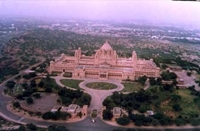
Jodhpur is the second largest city in the Indian state of Rajasthan. It is located 335 kilometres (208 mi) west from the state capital, Jaipur and 200 kilometres (124 mi) from the city of Ajmer. It was formerly the seat of a princely state of the same name, the capital of the kingdom known as Marwar. Jodhpur is a popular tourist destination, featuring many palaces, forts and temples, set in the stark landscape of the Thar desert. The city is known as the "Sun City" for the bright, sunny weather it enjoys all year. It is also referred to as the "Blue City" due to the blue-painted houses around the Mehrangarh Fort. The old city circles the fort and is bounded by a wall with several gates. However, the city has expanded greatly outside the wall over the past several decades. Jodhpur lies near the geographic centre of Rajasthan state, which makes it a convenient base for travel in a region much frequented by tourists. The climate of Jodhpur is generally hot and semi-arid, but with a rainy season from late June to September (Köppen BWhw). Although the average rainfall is around 450 millimetres (18 in), it is extraordinarily variable. In the famine year of 1899, Jodhpur received only 24 millimetres (0.94 in), but in the flood year 1917 it received as much as 1,178 millimetres (46.4 in).
-
Udaipur
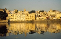
Udaipur also known as the City of Lakes, is a city, a Municipal Council and the administrative headquarters of the Udaipur district in the state of Rajasthan in western India. It is located 403 kilometres (250 mi) southwest of the state capital, Jaipur, 248 kilometres (154 mi) west of Kota, and 250 kilometres (155 mi) northeast from Ahmedabad. Udaipur is the historic capital of the kingdom of Mewar in the former Rajputana Agency. The Guhils (Sisodia) clan ruled the Mewar and its capital was shifted from Chittorgarh to Udaipur after founding city of Udaipur by Maharana Uday Singh. The Mewar province became part of Rajasthan after India became independent Apart from its history, culture, and scenic locations, it is also known for its Rajput-era palaces. The Lake Palace, for instance, covers an entire island in the Pichola Lake. Many of the palaces have been converted into luxury hotels. It is often called the "Venice of the East", and is also nicknamed the "Lake City".[2][3] Lake Pichola, Fateh Sagar Lake, Udai Sagar and Swaroop Sagar in this city are considered some of the most beautiful lakes in the state. Udaipur is a popular tourist destination in India. The lakes, palaces and lively workspaces and culture attract foreign and domestic visitors. It is a favourite marriage destination. Many celebrities, including film stars, business families, politicians chose Udaipur to hold marriage ceremonies and parties.
-
Bharatpur
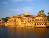
Bharatpur is a city in the Indian state of Rajasthan. It was founded by Maharaja Suraj Mal in 1733. Located in the Brij region, Bharatpur was once an impregnable, well-planned and well-fortified city, and the capital of Jat kingdom ruled by Sinsinwar Maharajas.The trio of Bharatpur, Deeg and Dholpur has played an important part in the history of India. Located 55 km west of the city of Agra (the city of the Taj Mahal) and 35 km from Mathura, it is also the administrative headquarters of Bharatpur District and the headquarters of Bharatpur Division of Rajasthan. The Royal House of Bharatpur traces its history to the eleventh Century AD. of this region are of most respected royal status in Rajasthan.
-
Mount Abu
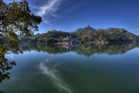
Abu Parvat or Mount Abu pronunciation (help·info) is a popular hill station in the Aravalli Range of Rajasthan state in western India. It is located in Sirohi district. Mount Abu is 58 km from Palanpur (Gujarat). The mountain forms a distinct rocky plateau 22 km long by 9 km wide. The highest peak on the mountain is Guru Shikhar, at 1,722 metres (5,650 ft) above sea level. It is referred to as 'an oasis in the desert', as its heights are home to rivers, lakes, waterfalls and evergreen forests. The ancient name of Mount Abu is "Arbudaanchal". The mountain is also home to several Hindu temples, including the Adhar Devi Temple (also known as Arbuda Devi Temple), carved out of solid rock; the Shri Raghunathji Temple; and a shrine and temple to Dattatreya built atop the Guru Shikhar peak and a number of Jain temples including Dilwara, a complex of temples carved of white marble that was built between the 11th and 13th centuries AD.
-
-
Rajasthan
-
-
Goa
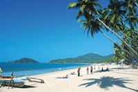
Goa is India's smallest state by area and the fourth smallest by population. Located in West India in the region known as the Konkan, it is bounded by the state of Maharashtra to the north, and by Karnataka to the east and south, while the Arabian Sea forms its western coast. Goa is India's richest state with a GDP per capita two and a half times that of the country as a whole.[4] It was ranked the best placed state by the Eleventh Finance Commission for its infrastructure and ranked on top for the best quality of life in India by the National Commission on Population based on the 12 Indicators. Goa features a tropical monsoon climate under the Koppen climate classification. Goa, being in the tropical zone and near the Arabian Sea, has a hot and humid climate for most of the year. The month of May is the hottest, seeing day temperatures of over 35 °C (95 °F) coupled with high humidity. The monsoon rains arrive by early June and provide a much needed respite from the heat. Most of Goa's annual rainfall is received through the monsoons which last till late September. The beaches in Goa are also ideal destinations for adventure enthusiasts. These offer excellent options for a wide range of water sports including swimming, river cruising along the Baga, Candolim and Calangute beach strips, dinghy sailing, parasailing, scuba diving, water skiing, water scootering, windsurfing, jet skiing and banana boat riding.
-
-
North Goa Beaches
Anjuna Beach Aramol Beach Ashwem Beach Baga Beach Candolim Beach Calangute Baga Dono Paula Beach Keri Beach Morjim Beach Mandrem Beach Miramar Beach Sinquerim Beach Siridao Beach Vagator Beach Vainguinim Beach -
South Goa Beaches
Agonda Beach Arossim Beach Bogmalo Beach Benaulim Beach Betalbatim Beach Betul Beach Cabo Da Rama Fort Beach Canaguinim Beach Cola Beach Colomb Beach Colva Beach Fatrade Beach Galjibaga Beach Hollant Beach Majorda Beach Mobor-Cavelossim Beach Palolem Beach Patnem Beach Raj Baga Beach Utorda Beach Varca Beach Velsao Beach
-
-
Goa
-
-
Kashmir
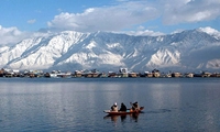
Kashmirs the northwestern region of the Indian subcontinent. Until the mid-19th century, the term Kashmir geographically denoted only the valley between the Great Himalayas and the Pir Panjal mountain range. Today Kashmir denotes a larger area that includes the Indian-administered state of Jammu and Kashmir (the Kashmir valley, Jammu and Ladakh), the Pakistani-administered Gilgit–Baltistan and the Azad Kashmir provinces, and the Chinese-administered regions of Aksai Chin and Trans-Karakoram Tract. Before insurgency intensified in 1989, tourism formed an important part of the Kashmiri economy. The tourism economy in the Kashmir valley was worst hit. However, the holy shrines of Jammu and the Buddhist monasteries of Ladakh continue to remain popular pilgrimage and tourism destinations. Every year, thousands of Hindu pilgrims visit holy shrines of Vaishno Devi and Amarnath which has had significant impact on the state's economy. The Vaishno Devi yatra alone contributes Rs. 475 crore to the local economy annually.
-
-
Srinagar
Srinagar is the summer capital of the Indian state of Jammu and Kashmir. It is situated in the Kashmir Valley and lies on the banks of the Jhelum River, a tributary of the Indus.[3] The city is famous for its gardens, lakes and houseboats. It is also known for traditional Kashmiri handicrafts and dry fruits. The hill station and skiing resort Gulmarg is 50 km from the city. For decades, tourism has been contributing massively to the economy of the city, but it has been adversely affected on account of insurgent activities by certain elements.[citation needed] The areas on the outskirts of Srinagar are also famous for their natural beauty. Also in this area lies the Muzaffarabad Cantonement, which is the main cantonement of the Indian Army in Srinagar District(the name of the Cantt. is often confused with Muzaffarabad city which is a separate city in Pakistan administered Kashmir) Srinagar is well known for its lakes. Dal Lake is known for its houseboats. Nagin Lake is another famous lake in the city. Houseboats were introduced accidentally to Kashmir: members of the Indian Civil Service of the British Raj serving in the plains who vacationed in Kashmir were not permitted to build permanent homes because of the then Maharaja's suspicion of a British presence in Srinagar.[citation needed] They thus chose to live in houseboats. The first such, named Victory, was designed by Mr MT Kenhard in 1888. There are now about five hundred on the Lake. Srinagar has a humid subtropical climate with a climate much cooler than what is found in much of the rest of India, due to its moderately high elevation and northerly position.

-
Gulmarg
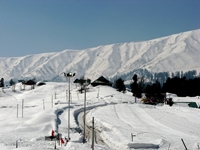
Gulmarg literally means meadow of flowers. It is a majestic hill station in the district of Baramula of Jammu and Kashmir in India. The hill station, at an altitude of 2730 m, was earlier known as Gaurimarg, where Gauri stands for Goddess Parvati the wife of Lord Shiva. The name Gulmarg was given to this place by the King Yousuf Shah Chak. Nestled with stunning peaks in the Himalayan ranges, Gulmarg is a spectacular picnic spot attracted by all kinds of tourists with its lush green backdrop, beautiful landscapes, flowering gardens, serene lakes and pleasant climate during the summers and falls. Gulmarg is easily accessible from Srinagar or Srinagar Airport (SXR), the capital of Kashmir, in under 2 hours by car or bus. Just 1 hour on the way is the town of Tangmarg, a key tourist attraction and also a main destination for skiers riding down from Gulmarg during the winter months. From Tangmarg, the Gulmarg plateau is just 30 minutes travel. Gulmarg has around 40 hotels ranging from extremely budget accommodation in private huts to hotels that are of a similar standard to a western Bed & Breakfast. When hotels say 5 star expect similar standards to the aforementioned bed and breakfast or motel. The peak season starts with the snowfall in December and lasts until March (April if it is a good season). The charges for one night stay during peak season in a hotel range typically between Rs1500 to Rs6500+, however there is also accommodation available for Rs500 which is only for the hardcore. The pre-season and post-season rates may have a discount but this is not standard.
-
Sonamarg
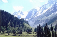
Sonamarg (translation: "Meadow of Gold") is a hill station in Ganderbal district in the Indian state of Jammu and Kashmir. Sonamarg gives rise to The Three Sisters (Kashmir). In its vicinity lies the great Himalayan glaciers of Kashmir Valley namely Kolhoi Glacier and Machoi Glacier with some peaks of above 5000 meters: Sirbal Peak, Kolhoi Peak, Amarnath Peak and Machoi Peak. Sonamarg an alpine valley is situated at the bank of Nallah Sindh, 87 km north-east from Srinagar, it is a popular tourist destination, nestled with in the imposing Himalayan peaks. Sonamarg, which means ' meadow of gold ' has, as its backdrop, snowy mountains against a cerulean sky. the Sindh meanders along here and abounds with trout and mahseer, snow trout can be caught in the main river. In late april when Sonamarg is open for road transport, the visitors can have access to snow which is furnished all over like a white carpet. Ponies can be hired for the trip up to Thajiwas glacier a major attraction during the summer months. However, there is need for some stricter regulation to save the environment of the area from over tourism. Litters such as plastic bottles, etc., are strewn all over along the track.
-
-
Kashmir
-
-
Ladakh
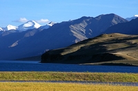
Ladakh a word which means "land of high passes", is a region in the state of Jammu and Kashmir of Northern India sandwiched between the Karakoram mountain range to the north and the Himalayas to the south. The Indian portion of Ladakh is composed of the Leh and Kargil districts. The Leh district is the largest district of India, covering more than half the area of Jammu and Kashmir, of which it is the eastern part Ladakh is one of the most awesome places on the planet ("awesome" in its original sense). This semi-autonomous kingdom is India's most remote and least populated region, a mixture of snow-capped peaks, green valleys, glassy lakes and Buddhist monasteries..
-
-
Nubra Valley
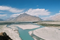
Nubra Valley is about 150 km north of Leh, the capital town of Ladakh, India. Local scholars say that its original name was Ldumra (the valley of flowers). The Shyok River meets the Nubra or Siachan River to form a large valley that separates the Ladakh and the Karakoram Ranges. The average altitude of the valley is about 10,000 ft. above the sea level. The common way to access this valley is to travel over the Khardung La from Leh. Non-locals require an Inner Line Permit (obtainable in Leh town) to enter Nubra. Along the Nubra or Siachan River lie the villages of Sumur, Kyagar (called Tiger by the Indian Army), Tirith, Panamik, Turtuk and many others. Samstanling monastery is between Kyagar and Sumur villages, and Panamik is noted for its hot springs. Across the Nubra or Siachan River at Panamik, is the isolated Ensa Gompa.
-
-
Ladakh
| Home | | | About us | | | Destination | | | Packages | | | | | Contact Us |


